
We have been looking in detail at the Armada Way Biodiversity Net Gain assessment report and calculations, which were provided as part of Plymouth City Council’s ‘Meaningful Community Engagement’. We referred to the Biodiversity Net Gain Metric 3.1 User Guide and additional guidance. This document details our thoughts on the assessment. In summary, we believe the assessment has several flaws that led to the baseline (existing) habitat being undervalued. We also found there was a major flaw in the Metric itself, which led to a significant overestimation of new tree (post-intervention) habitat area. The new Metric (4.0), which supersedes the one used in this assessment, has rectified this issue. If the new Metric were to be used, well over 1000 new trees would need to be planted on site to compensate for losses of healthy, mature trees and achieve the required Biodiversity Net Gain.
Background to Biodiversity Net Gain
Plymouth City Council (PCC) along with many other local authorities, were early adopters of Biodiversity Net Gain (BNG), which is due to become mandatory in November 2023 as part of the Environment Act 2021. While planning permission for nearly all new developments will require a biodiversity increase of 10% or more, Plymouth City Council have decided that they will require at least 20% BNG for this scheme.
The BNG Assessment for the Armada Way development claimed that a 25.09% BNG would be delivered on site. Biodiversity Metric 3.1 was used for the assessment, which was undertaken by the Environment Partnership (TEP) using YGS tree survey data; with baseline habitat ‘walkover survey’ data provided by a local ecologist. The Biodiversity Metric is a tool used by ecologists to measure changes in biodiversity on a development site. Biodiversity Metric
3.1 has now been superseded by Biodiversity Metric 4.0, which was released on 24 March 2023 (more on this later).
In a BNG Assessment, the biodiversity value of a development site, pre and post ‘intervention’, is measured. Post-development biodiversity value can be increased through the enhancement of baseline habitats and/or the creation of new ones either on or offsite.
Biodiversity value is calculated in Habitat Units (HUs). These are derived from the habitat area, the habitat’s ‘distinctiveness’ and its condition, as well as any ‘strategic significance’ applicable to the site of the habitat. The time taken to achieve the target condition of newly created habitats is also taken into account, as well as the difficulty involved in creating the habitat. A 30-year maintenance and monitoring plan must be included to ensure newly created habitats will survive and reach the desired condition within the period.
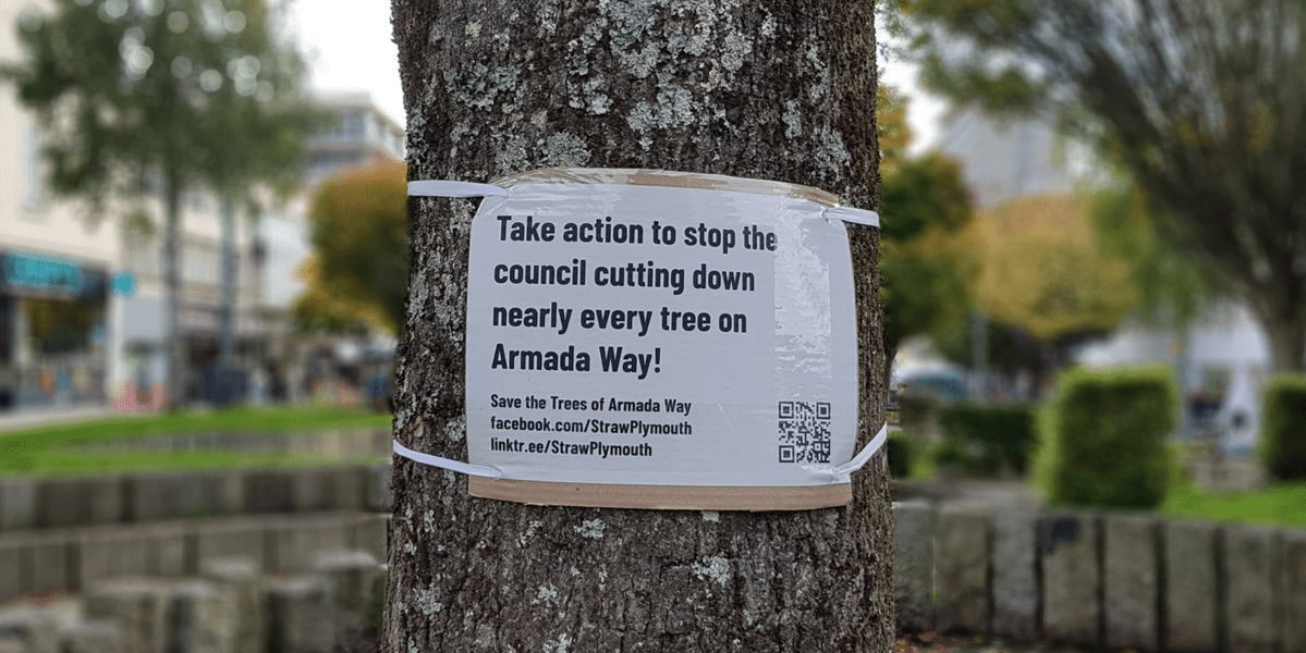
Requests from STRAW for further information and evidence
STRAW tell us that they had several concerns and queries regarding the Armada Way BNG Assessment so wrote to the assessor asking for clarification on several points. They also wrote to the ecologist who carried out the baseline habitat walkover survey. Despite a follow-up email, they never received a reply from the assessor. The Armada Way development project manager at PCC, assured STRAW and Plymouth Tree Partnership that the BNG Assessment had been ‘triple checked’ and peer-reviewed and promised that the peer review would be shared. Despite repeated requests, this information was never shared.
Concerns about the Armada Way assessment
Significant overestimation of post-intervention habitat area
One of STRAW’s main concerns around the BNG Assessment for Armada Way, was the significantly greater habitat area ascribed to post development (new) trees than to the existing trees, due to an issue with the Metric itself. We accept that the PCC’s ecologist followed Metric 3.1 correctly in using actual Root Protection Area (RPA) calculations for the existing trees and in using the ‘Urban Tree Helper’ tool for new trees to be planted. However, the two methods are not comparable. If the existing tree measurements had been put into the Urban Tree Helper tool, instead of a habitat area of 0.67 hectares (ha), they would have had a habitat area of over 3 ha. This significant flaw in Metric 3.1 has now been addressed in Metric 4.0, which now requires existing tree habitat measurements to be entered into the tool as well as post-intervention (new tree) measurements.
Note: Root protection area (RPA) is used as a proxy for tree habitat area. RPA is calculated using a standard equation provided in BS5837:2012 – Trees in relation to design, demolition and construction. Recommendations, using the ‘diameter at breast height’ (DBH) measurement, where the diameter of the trunk is measured 1.5m above ground.
Although we believe PCC’s ecologist followed the 3.1 User Guide correctly for habitat area calculations, (i.e. using actual root habitat area for the baseline trees and the Urban Tree Helper tool for new trees) we believe they should have noted the significant flaws in the use of different methods for the baseline and post-intervention calculations, which result in the lowest possible habitat area for baseline trees and a significantly exaggerated habitat area for newly planted ones.
Issues with use of the Urban Tree Helper tool only for the new trees
The BNG Urban Tree Helper tool assigns trees to ‘Small’, ‘Medium’ and ‘Large’ categories, according to their DBH. When considering the categories for new trees to be planted, the ‘Small’ category is for trees with a DBH of between 7cm and 30cm after 30 years and the ‘Medium’ category for trees with a DBH of >30 – <=90cm after 30 years. Large category trees are those with a DBH of 90 cm or over.
The 33 new trees (to be planted) were assessed as reaching the ‘Medium’ category after 30 years. Having consulted tree experts and looked at the available literature, we do not believe that these 33 trees should have been assigned to the Medium category. They should have been assigned to the Small category. What is really interesting is that the Medium category trees – those with a DBH of between >30 and <=90cm – are all given a ‘metric area equivalent’ of a tree with a 90cm DBH, so that even a 31 cm DBH tree has the equivalent habitat area of a 90cm DBH tree. This obviously means a significant overestimation in the habitat area for a tree of 31cm DBH. Our researches have found that, if these trees did reach the medium category after 30 years, which is very unlikely, they would only just enter this category – i.e. they would be at the very low end of the range.
Importantly, an existing tree with a 30cm DBH, using Metric 3.1, would be given a habitat area based on 30cm – 0.0041 ha whereas a newly planted tree – still expected to reach a DBH of 30cm after 30 years, would be assigned a habitat area of 0.0366 ha. This is clearly ridiculous given that they are both the same size trees.
Using Metric 3.1, if there were 100 existing trees due to be felled, that all had DBHs of 30cm, the total habitat area would be 0.41 ha. If these were to be replaced by 100 trees that were expected to achieve a DBH of 30cm after 30 years, they would be credited with a habitat area of 3.66 ha even though they would probably never grow so large. This demonstrates this important failing of Metric 3.1 and the huge overestimation of the habitat value of newly created tree habitat area as part of the proposed scheme. Fortunately, this has been addressed in Metric 4.0, with the requirement for existing trees also be assessed using the Urban Tree Helper tool – though this is now too late for the Armada Way trees. Metric 4.0 also addresses the issue of newly planted trees being wrongly assigned to the Medium category and thereby achieving a significantly exaggerated habitat area. All new trees must now be assigned to the Small category unless there is strong evidence to support assigning them to higher categories.
We entered baseline tree data into the Urban Tree Helper tool. The Results show a much higher baseline habitat area (over 3 ha) when following the Metric 4.0 User Guide. Post- intervention habitat area is 1.6 ha; a net loss.
Other concerns with the BNG assessment
Not including all existing trees in the baseline calculations
Apart from this obvious flaw that significantly overestimates new habitat area, we believe the assessment also has several other flaws. There were 11 ‘Category U’ trees that should have been included in the baseline habitat area calculations but were left out. These are trees that were considered unsuitable for retention under BS5837:2012. They should however, according to the Metric 3.1 User Guide, have been included in the baseline calculations. This would have given a greater total habitat area for the baseline urban trees on the site.
Trees growing in groups were also disregarded and counted as just one tree. Had they all been assessed then this would also have increased the baseline habitat area (as detailed in Section 7 of User Guide 3.1).
Misleading statements on damage to the built environment
The BNG assessment stated that ‘the current tree stock is understood to be generally inappropriate to their urban setting, with several causing damage to the built environment’. No evidence was referenced to underpin this statement in relation to Armada Way, and it is not relevant to a BNG Assessment save for assessing their condition. The assessor appears to have used data from a larger tree survey of the area (487 trees), not just Armada Way, and there seems to be no clear evidence in the reports that damage had occurred in Armada Way from the existing (now mostly destroyed) tree stock.
Strategic significance
The BNG Metric includes a consideration of ‘strategic significance’ where local plans and strategies are taken into account. We believe there is room for doubt over the strategic significance being set as ‘low’. The Plymouth and South Devon Joint Local Plan, the Plymouth Plan for Trees and the Plymouth Policy Area Open Space Assessment were possibly relevant and if included might have justified setting the baseline ‘strategic significance’ at ‘medium’ or ‘high’. The Plymouth and South Devon Joint Local Plan refers to the mitigation hierarchy: ‘AVOID LOSS – retain suitable existing arboricultural features on site wherever possible’. DEV26.5 in the plan states that ‘applying Biodiversity Net Gain is not an alternative to the application of the mitigation hierarchy and it would be unacceptable practice for a developer to compensate without first seeking to avoid and mitigate’. Whether or not this should have been considered under ‘strategic significance’, it should have been an important consideration for the project. There appears to be no evidence of any attempt, at any stage of the design process, to retain existing healthy, mature trees.
The Plymouth Plan for Trees (2018) also does not appear to have been considered. The following principles should arguably have been taken into consideration:
- Plymouth’s trees and woods should be celebrated. Arguably an urban forest in the heart of the city, which happens to be a designated public green space and in a ward with well below average tree cover, should have been valued and celebrated and included in the design from the early stages. Tree canopy cover in the St Peter and the Waterfront ward is 9.3% (forestresearch.gov.uk). The national average for council wards is 16%. The minimum council wards should aim for is 20% (Woodland Trust, 2023). New trees, even if greater in number, would have a much-reduced canopy cover, even in the longer term.
- Use all available planning and forestry legislation and powers to safeguard Plymouth’s trees. It would be expected that the Plymouth and South Devon Joint Local Plan (adopted in 2019) would have informed the process, particularly: ‘AVOID LOSS – retain suitable existing arboricultural features on-site where-ever possible’.
- Increase overall canopy cover in the city. The Armada Way proposal appears to reduce canopy cover, despite tree numbers increasing. Tree canopy cover in the St Peter and the Waterfront ward (that Armada Way lies within) is 9.3% (forestresearch.gov.uk). The national average for council wards is 16%. The minimum council wards should aim for is 20% (Woodland Trust 2023).
The Plymouth Policy Area Open Space Assessment identified Armada Way as a Green Corridor. This does not seem to have been considered and could potentially have increased the ‘strategic significance’ score in the BNG assessment. If these plans and strategies were considered and ruled out as having ‘strategic significance’, the reasoning should have been explained in the assessment, or at least provided upon request, to meet BNG transparency principles.
Habitat condition
There may also have been an undervaluation of the condition of tree habitat and ‘other habitats’ in the assessment. The lichen, bryophyte and other epiphyte communities associated with the existing trees (now gone) does not seem to have been adequately considered. There is the potential for bat roosts, and we have photographs of bryophytes, lichen communities and fungi associated with the trees. There were also a number of nests in the trees that were felled (not active ones, but evidence of the suitability of the trees for nesting). These factors form part of the condition assessment of Urban trees.
The condition of grass habitats and hedge features were set to low, even though they had recently been significantly cut back, and according to the User Guide, they should have been given higher scores as a precautionary measure if recently altered/ cut back. We noted at least 10 different plant species making up the grass habitats, possibly over 15 species. If these had been considered, as they should have been, the condition score would have been higher. When we queried this with the ecologist who undertook the habitat walkover survey, they said they visited the site for an hour to look at the grassland which had just been mown and that he was not involved in the BNG assessment. We also understand that the survey was also carried out during the intense heatwave of 2022.
Lack of maintenance budget
It should be noted that the stated BNG (25.09%), which we believe we have shown here to be incorrect, was to be achieved after 30 years. No maintenance budget had been identified beyond the project construction period (approx. 2 years). Further maintenance funding was to be sought from future (unknown) levies on residential development projects, i.e. funding for 28 years of maintenance had not been secured. With the significant uncertainties over changing climatic conditions over this period, and temperature increases highly likely, we would expect a low confidence in survival potential of newly planted trees. This does not comply with the new provisions of the Environment Act 2021 which require that post intervention habitats be maintained for at least 30 years.
From our detailed analysis, we have advised STRAW that if PCC used the same baseline data for urban tree habitat with the baseline urban tree habitat updated to 3.1137 hectares, which is the area calculated using Metric 4.0, PCC would need to plant at least 1,384 ‘Small’ category trees to achieve at least the 20% net gain promised. On this basis, we calculate that the plans as detailed in the TEP BNG assessment will instead deliver a 62.10% net loss of habitat.
Here is a copy of our BNG 4.0 calculation.
Here is a copy of our Urban tree habitat area calculation.
Conclusions and recommendations
We conclude that, ignoring the other issues identified above, even if PCC’s calculations were compliant with the Metric 3.1 User Guide, the information detailed here highlights the actual losses on the ground. These losses should be of concern to PCC and should be communicated to the public. It is too late to amend the plan to include the 110 healthy mature trees that have now been felled. The remaining trees could however be included. Significantly more trees would need to be planted to compensate for these losses than the number currently proposed, and even more to achieve the 20% biodiversity net gain aspired to. We believe that both the assessment and the methodology were flawed and that this is an important case study that should inform other projects.
In our view, it would be prudent now for PCC to undertake a new BNG assessment (particularly as plans have since been amended and most of the trees surveyed have now been felled) using Metric 4.0 and to publicly share the findings, especially given the previous lack of transparency on the ecological assessments.
We sincerely hope that they will do this and meet their obligation to make good the losses which Plymouth has suffered.
