Assessing habitat parcels: strategic significance explained

To calculate the biodiversity value of a habitat, it’s important to assess its strategic significance. A habitat’s strategic significance takes into account both its type and its location. If strategic significance is high, then the habitat’s value will be uplifted by 15%. However, as this article explains, the opportunities for doing this are limited.

A habitat parcel is an area of habitat which is all of the same distinctiveness, condition and strategic significance. Strategic significance refers to the importance of a habitat parcel based on its location and type.

Each habitat parcel needs to be assessed both before, when the baseline habitat is surveyed, and after development, on or off site.

This flowchart sets out how to assess the strategic significance of a habitat parcel. It uses the tables, shown below, from the Statutory Biodiversity Metric User Guide.


Our blog, The Local Nature Recovery Strategy fails to deliver for Bristol assesses the implications of this for Bristol, which recently adopted the WECA LNRS.


These are the tables referred to in the flowchart:

Table 7: strategic significance categories where an LNRS has been published.

Table 8: strategic significance categories where an LNRS has not yet been published.

Replacing lost biodiversity: a missed opportunity for local offsetting?

When developers cannot meet their obligation to replace habitat lost within their development site, plus at least 10%, they may buy habitat units to offset this lost habitat. These habitat units are available in ‘biodiversity gain sites’.

This article was updated on 23 February 2025 to take account of the development of our new site which dynamically analyses the Biodiversity Gain Register and collates and summarises the published data:

The BGS Register

To date, 46 of these biodiversity gain sites (BGS) have been registered in England. They provide:

  • 1,376.7 hectares (ha) of baseline area habitat.
  • 32.76 kilometres (km) of baseline hedgerow habitat.
  • 11.37 km of baseline watercourse habitat.

The BGS sites cover 1,770.41 ha, though not all of this area is used for habitat improvement. 1,420.83 ha baseline habitats are made available for offsetting habitat loss caused by development elsewhere where this lost habitat cannot be replaced on the development site itself.

Distribution of biodiversity gain sites in England

19 of the 46 BGS sites are controlled by  RSK Biocensus Limited as the Responsible Body but are mostly owned by Environment Bank. One other is controlled by  Harry Ferguson Holdings (based on the Isle of Wight) as the Responsible Body, with the remaining sites under the control of various Local Planning Authorities (LPA) as the Responsible Body. We assume that the LPA sites have been created in order to deal with those local developments which require offsite mitigation. Nonetheless, these sites are also selling habitat to developers which require offsite mitigation but are outside the LPA boundary.

We also ask who is policing these sites to ensure that was has bee promised is being delivered? This must especially be the case for LPA sites given that the LPA cannot monitor itself?

In Bristol the LPA has delegated this function to neighbouring authorities using s.101 Local Government Act 1972 (the power for councils to delegate functions to other local authorities). – See 30 Sept 2024 Economy and Skills Committee notes – from paragraph 9. It will be interesting to see how this turns out. However, despite this, no BGS sites have yet been registered in the city, so it is hard to see how this initiative will be delivered where offsite mitigation is required.


The habitat improvement potential

These sites provide a total of 4,819.3 area baseline habitat units (HUs), 325.59 hedgerow baseline HUs and 105.6 watercourse HUs – we have assumed that all the sites have low strategic significance and that the watercourse habitats are free of encroachment.

We have been able to calculate the improved habitat units being created but not the improved habitat units being enhanced. This is because the parameters upon which these baseline habitats are being improved have not been identified.


The take up to date

So far, 31 of these 46 BGS sites have been used by 59 LPAs to allocate lost habitat caused by 85 developments. The majority of habitats are Other neutral grassland and the remainder are Lowland meadows, Traditional orchards, Floodplain wetland mosaic and CFGM, Mixed scrub, Woodland and forest and Hedgerow habitat.

To encourage developers to choose sites as close as possible to the habitat loss, they don’t need to pay a ‘spatial risk’ penalty if the biodiversity gain site is within the same Local Planning Authority (LPA) as the development. However, if the biodiversity gain site is outside the LPA for a particular development, the developer must pay a penalty when calculating the number of habitat units to be offset. If the site is in an adjacent LPA, the penalty is 25%. If it is farther away, the penalty is 50%.

Unfortunately, it appears that developers are not using BGS within their LPA areas (if available) for offsetting but are paying the spatial risk premium, though perhaps this is because they have no choice as there are no local BGS sites available.

Our analysis shows that, to date, the average distance between the centre of the LPA* where the habitat was lost and where its loss is offset is 80.1 km, with the greatest distance between loss and replacement being 344.8 km. Only six sites are within 10 km of the site of the habitat loss, while 23 are over 100 km away.

* It is difficult automatically to calculate the exact site of the habitat loss on the basis of the information provided. If at least Post Codes were provided, this would be possible.

What is particularly notable is that many of the development sites we have examined appear to be in locations where there should be ample opportunities for local habitat to be improved, but nothing has been done to realise this. Even the South Downs National Park LPA has allowed the replacement of habitat lost in two applications on the same site under its care near Petersfield to be exported to a site some 67 km away near Lewes, albeit that it is still in the National Park.

Furthermore, all 46 of the BGS sites are located on private land, in rural settings that are not easily accessible, whereas the lost habitats were largely located in built-up areas.

However, given the requirement that offsite mitigation only be delivered on registered sites, its hard to see what choice developers have apart from testing the BGS market and buying the cheapest habitats required, albeit that this may be miles from the site of the original loss.

This is still a small sample, which will grow over time so, perhaps this will change as more biodiversity gain sites become available and a clearer trend emerges. At the moment, however, the trend is not encouraging and looks like it will result in local nature, especially in urban settings, becoming hollowed out, as we feared it would when the biodiversity net gain requirements became obligatory nearly a year ago. See our article on this: It seems inevitable Bristol will see a steady, inexorable biodiversity decline

The Local Nature Recovery Strategy fails to deliver for Bristol

WEMCA’s Local Nature Recovery Strategy (LNRS) will fail to provide Bristol with the benefits promised for nature. While the new Biodiversity Net Gain (BNG) rules require most development in the city to increase biodiversity by at least 10%, unfortunately the LNRS will not apply to most potential development sites.

The West of England Mayoral Combined Authority (WECA as was) Local Nature Recovery Strategy was published to much fanfare last November. Defra’s blog, Kickstarting local nature recovery: a new strategy for the West of England, hailed it as the first in the country.

The LNRS is a locally led and evidence-based strategy which aims to target action and nature investment where it’s most needed. We’re told that the strategy will also focus on biodiversity net gain by increasing the strategic significance of specific habitats. However, it is hard to imagine how the LNRS will help to enhance biodiversity net gain in most, if not all, potential development sites in the city.

We might have been better off, at least as far as the application of biodiversity net gain to new development is concerned, by asking the LPA to specify alternative documents (such as those listed at the end of this article) for assigning strategic significance instead.


The issue

When calculating the impact of a proposed development on biodiversity, one factor taken into account is the strategic significance of any habitat found on a focus area for nature recovery site (coloured purple in the map above). If strategically significant habitats are created or enhanced, then their strategic significance is set to High in the Statutory Metric calculator tool and a 15% uplift to the calculation of its value is applied. Subject to which of the six LNRS areas is being considered, these are the strategically significant habitats in the city:

  • Ditches
  • Ecologically valuable lines of trees
  • Ecologically valuable lines of trees – associated with bank or ditch
  • Grassland – Floodplain wetland mosaic and CFGM
  • Grassland – Lowland calcareous grassland
  • Grassland – Lowland meadows
  • Heathland and shrub – Mixed scrub
  • Heathland and shrub – Willow scrub
  • Individual urban or rural trees
  • Lakes – Ponds (priority habitat)
  • Priority habitat (on the River Avon and the Riparian buffers)
  • Species-rich native hedgerow with trees – associated with bank or ditch
  • Species-rich native hedgerow with trees
  • Species-rich native hedgerows – associated with bank or ditch
  • Species-rich native hedgerows
  • Urban – Open mosaic habitats on previously developed land
  • Urban – Biodiverse green roofs
  • Woodland and forest – Lowland beech and yew woodland
  • Woodland and forest – Lowland mixed deciduous woodland
  • Woodland and forest – Other woodland; broadleaved
  • Woodland and forest – Wood-pasture and parkland

However, a detailed examination of the LNRS map reveals that not all parks and green spaces have been designated as focus area for nature recovery sites. It’s only those which are in one or both of the following:

  • a location where they can make a greater contribution to ecological networks
  • deprived areas with a lack of access to nature.

These designations were based on Bristol’s previous work on ecological networks within the city and where wildlife-friendly interventions are most likely to be feasible. This means that the existence, creation or enhancement of these special habitats outside these areas will not attract the 15% strategic significance uplift.


The BNG requirements

The now compulsory Statutory Metric Guide, used for calculating Biodiversity Net Gain (BNG), advises (at page 27) that: ‘Strategic significance is the local significance of the habitat based on its location and habitat type. You should assess each individual habitat parcel, both at baseline and at post-intervention, for on-site and off-site.

If the LPA has adopted an LNRS then only the High or Low strategic significance multipliers can be used (High – formally identified in local strategy = 1.15. Low – area compensation not in local strategy = 1). If it has not adopted an LNRS, then the Medium strategic significance multiplier may also be used (Location ecologically desirable but not in local strategy = 1.10).

Where an LPA has adopted an LNRS, all those sites which have not been identified as a focus area for nature recovery site will be designated as having Low strategic significance and so attract no uplift, even if they’ve been identified as important habitats in the Local Plan or in another strategic document adopted by the Council. These documents (used where an LPA has not adopted an LNRS) can include:

  • Draft Local Nature Recovery Strategies
  • Local Plans and Neighbourhood Plans
  • Local Planning Authority Local Ecological Networks
  • Parks and Green Spaces Strategies
  • Tree and Woodland Strategies
  • Area of Outstanding Natural Beauty Management Plans
  • Biodiversity Action Plans
  • Species conservation and protected sites strategies
  • Green Infrastructure Strategies
  • River Basin Management Plans
  • Catchment Plans and Catchment Planning Systems
  • Shoreline management plans
  • Estuary Strategies

Baseline habitats cannot be uplifted

Despite the BNG strategic significance guidance, Defra has stated that LNRS designations only apply to the creation or enhancement of post-development biodiversity mitigation habitats. They don’t apply if these habitats – called the baseline habitats – are found on the site before development begins.

This means that the 15% strategic significance uplift can only be applied where offsite biodiversity mitigation is being delivered in a focus area for nature recovery site. If these habitats are being delivered elsewhere, the uplift may not be applied.

However, even if the baseline habitats were included, it is unlikely to make any difference This is because the focus area for nature recovery sites identified in Bristol are, for the most part, located in public parks or green spaces, on river banks, in riparian buffers or on railway margins, none of which are likely ever to be developed or, in many cases, used to offset habitat lost to development elsewhere.

So far, no announcement has been made as to whether any of Bristol’s focus area for nature recovery sites will be made available for offsite habitat mitigation and the proposed new Local Plan does not commit to using these sites for this purpose.

This, combined with the challenge of finding LNRS suitable for offsite habitat mitigation, registering them as biodiversity gain sites and then managing them, effectively, in perpetuity, suggests that few feasible LNRS sites will be found, especially as many sites are also in demand for public access for recreation.

We set out the process used to assess the strategic significance of habitats on our blog, Assessing habitat parcels: strategic significance explained.

The 2025 Annual Tree Giveaway – free saplings available for planting

Many thanks for of of you who have asked for trees – over 1,200!

We have now closed the offer.

Planting a tree is, perhaps, one of the most significant things we can do to help protect our future environment, promote nature and make the world a better place for the generations to come. The trees we plant today will continue to provide benefits for the environment, wildlife and people, for hundreds of years.
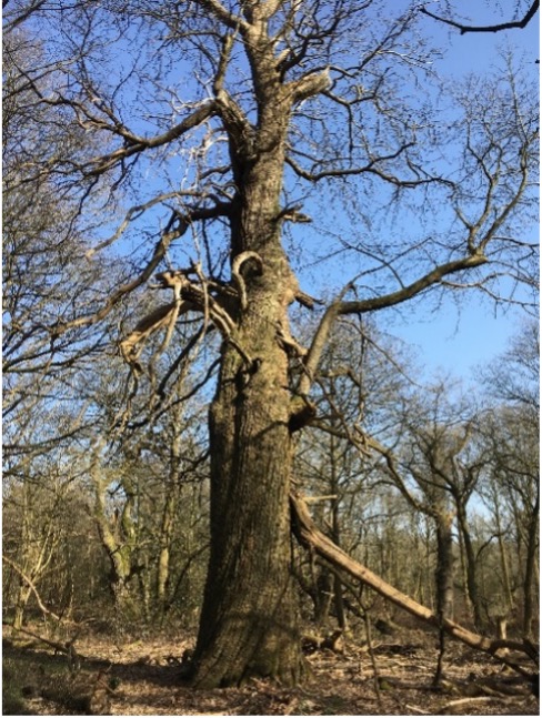
A veteran chestnut

We all know the value of trees in sequestering carbon, and they still represent the most effective and widespread means of removing CO2 from the atmosphere. For instance, a single mature oak tree is the equivalent of 18 tonnes of CO2 or 16 passenger return transatlantic flights. However, it is in our cities that trees provide the greatest benefits; cleaning our air, reducing flooding, improving our physical and mental health, and, crucially, reducing temperatures during heat waves.

Our cities suffer additional problems during heat waves, with all of the concrete and tarmac absorbing a lot of energy from the cooling sun and releasing it as heat. This “heat island” effect can raise temperatures by as much as an additional 12 degree centigrade. Trees can greatly reduce, or even eliminate, this effect, partly through shade but also actively cooling the air by drawing up water from deep underground, which evaporates from the leaves… a process called evapotranspiration. According to the US Department of Agriculture, this cooling effect is the equivalent to 10 room sized air con units for each mature tree. This cooling greatly enhances our resilience to the dangerous heat waves that are predicted to increase in severity and frequency.
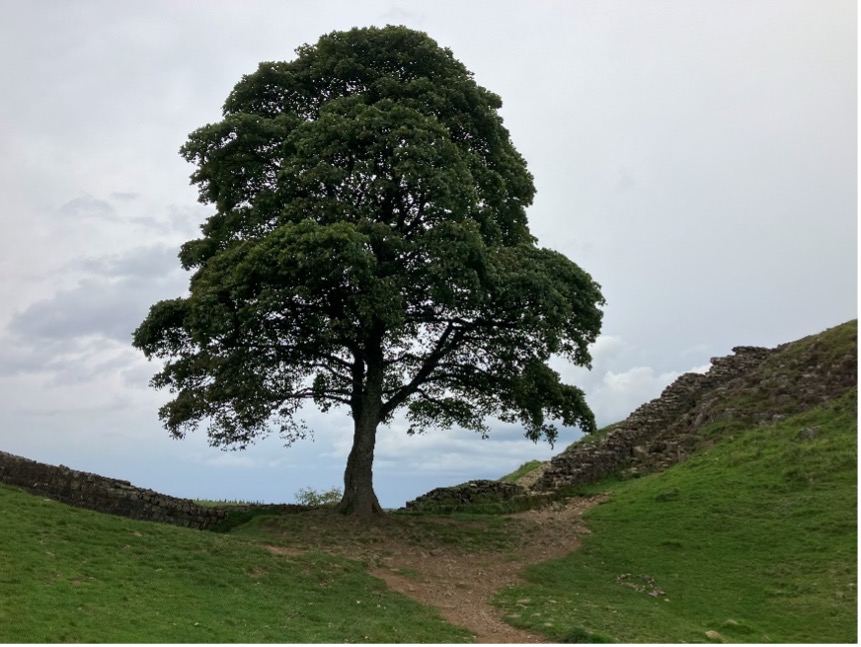
A veteran Beech

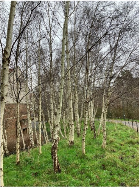
A stand of Silver birch

Also, Trees improve air quality by absorbing both gaseous (e.g., NO2) and particulate pollution. They reduce traffic noise and flooding and improve physical and mental wellbeing.

Thus, trees are a crucial, but often ignored, element in increasing our resilience to climate change.


What are the Bristol Tree Forum doing to help?

It is said that the best time to plant a tree is 20 years ago, and the second-best time is now.

Unfortunately, important mature trees are constantly being lost to development, damage and disease. Though these might easily be replaced by new trees, what is less easy is replacing the decades or even centuries that the tree has taken to grow, the carbon that the tree has sequestered, the ecosystems the tree supports and all of the other benefits trees provide. For these reasons, most of the work of the Bristol Tree Forum focuses on protecting our existing trees. These efforts are particularly crucial in the urban environment where our trees are under the greatest threat.

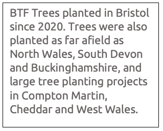
However, as well as advocating the retention of life-saving trees in our city, Bristol Tree Forum have been encouraging new tree planting by holding an annual tree giveaway since 2020; the ancient trees of the future are being planted today! Most of Bristol’s trees are sited in private land and gardens, so the trees we have are mostly thanks to the efforts of Bristol residents, and it is those residents we must look to if we want to increase our tree canopy.

Over the last four years, we have given away around 10,600 trees, with species as diverse as English and Sessile oak, Downy birch, Silver birch, Grey birch, Alder, Alder buckthorn, Rowan, Scots pine, Sweet chestnut, Sycamore, Spindle, Wild cherry, apple, pear and plum.

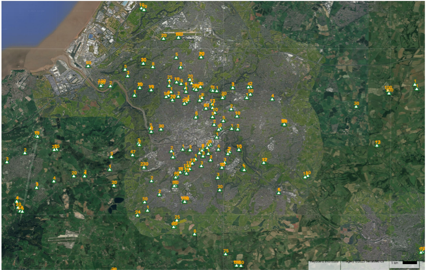
The trees planted to date.

Trees given away in 2022 / 2023
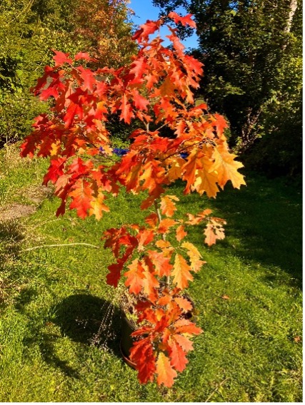
Red oak sapling

This year’s Tree Giveaway has been made possible by the generous support of Maelor Forest Nurseries, based on the Welsh borders, and Protect Earth whose aim is to plant, and help people plant, as many trees as possible in the UK to help mitigate the climate crisis.

Thanks to Maelor, we are able to offer a variety of species with a wide range of sizes and preferred habitats, including Pedunculate (English) oak, Red oak, Sweet chestnut, Silver birch, Sycamore, Hawthorn, Beech, Hornbeam, Wild cherry, Alder, Red alder, Field maple and Norway maple.


Trees can be ordered using the form below

We will get delivery of trees in February, when the trees can be collected from a site in Redland, Bristol. We will email you when they are ready.

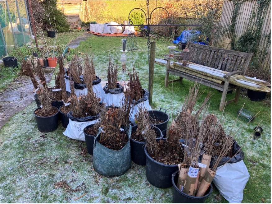
The saplings come bare-rooted (i.e. out of the soil) and will need to be planted as soon as possible after collection, although the viability of the trees over winter can be extended by storing the trees with the roots covered in damp soil.

The form below is to find out who would like to have saplings for planting, which species, how many and where you plan to plant them.

Please provide your email so we can contact you organise collection of the trees. Your contact details will be kept private and will not be used for any other purpose than to process your request.


Our Giveaway offer has now been filled.

Thanks for all your support.